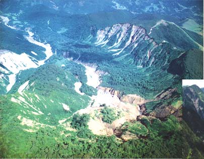
| Collapse of Mt. Hieda |
 |
In the drainage area of the Urakawa River that flows into the Himekawa
River, there are distributed a collapsed area of Mt. Hieda known as one
of the three greatest collapses in Japan and many slide areas. It is recorded
that the collapse of Kanayamasawa on Mt. Hieda in the 11th year of the
Kyoho era (1726) and the great collapse of Mt. Hieda in the 44th year of
the Meiji era (1911) dammed up the Hime-kawa River, and caused a flood.
The latter, in particular, was a great disaster, and twenty-three lives
were lost. It was a disaster brought about by a large-scale collapse because
of the brittle geological features of Mt. Hieda.
|
|
 |
 |
| Sediment produced without intermission |
|
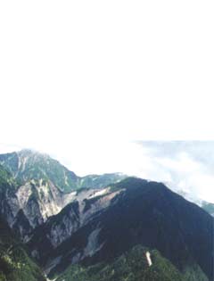
The geological features in the North Alps area can be divided roughly into
the sedimentary rock and the igneous rock in the new tertiary zone of Fossa
Magna to the east and the granite in the old tertiary zone to the west
along the border of Fossa Magna. The majority of the geological features
that form the drainage area of the Takasegawa River is occupied by the
granite.
The granite made of coarse grain is extremely vulnerable to weathering, and is the root of sediment production when the conditions are added such as complicated faults, weathering through the action of a hot spring, and area of rocks exposed exceeding the forest limit, etc. The soil that flows out without intermission poses a threat of sediment-related disaster to the drainage area. |
|
|
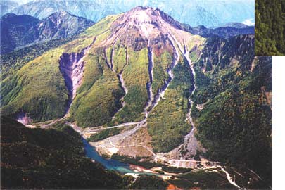
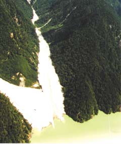
Mt. Yakedake that produces volcanic soil
|
|
Lava and ashes spewed out from Mt. Yakedake that repeats an eruption become piled up, and forms an extremely brittle ground. Apart from the damages caused by the fumes and ash fall, the sediment flows out of the devastated mountain streams endlessly, and a large quantity of sediment is piled up in the upper reaches of a river. Mt. Yakedake is a violent mountain with the geological features that cause the disasters such as collapse, debris flow, and flood. |
|