1935On 25th September, the Uonuma District was assaulted by an unprecedented heavy storm and numerous landslides occurred along Uono River, causing major flooding Fifty nine settlements and some 600 ha of farmland were flooded, making a gigantic temporary lake. The sediment damage was also very severe. |
 |
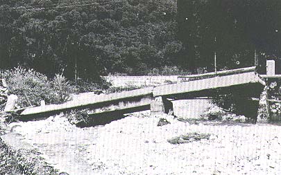
 Scene of Yunosawa River in September 1935 (Yuzawa Town) |
|
|
 |
1948On 16th September, Ion Typhoon hit the Uonuma District after landing on Honshu Island from the sea to the south and caused extensive damage, particularly in the upper reaches of Uono River and also in areas along Kiyotsu River and Nakatsu River. In addition to substantial damage to property, two persons was killed and another was reported missing. Following a series of disasters in the late 1940's, the drainage areas of Kiyotsu River and Nakatsu River were integrated in the sabo zone directly controlled by the Ministry of Construction in fiscal 1951. |
1964From 7th to 8th June, the seasonal rain front, which had been stagnant over the Kubiki and Uonuma Districts, became very active, causing a downpour in the upper reaches of Aburuma River, the largest tributary of Uono River. The damage totaled \ 1.7 billion and Irihirose Village(now:Uonuma City)located in the uppermost reaches was the main victim. Following this disaster, sabo works directly controlled by the Ministry of Construction commenced in the drainage area of Aburuma River in fiscal 1968. |
||
1969On 11th August, a rain front running diagonally above central Honshu Island gradually moved northwards and caused a downpour in the area around Muika Town(now : Minamiuonuma City) in the drainage area of Uono River. This downpour caused unprecedented damage to Saguri River and the total damage, including that to Yamato (now : Minamiuonuma City), Koide(now : Uonuma City) and Horinouchi Towns (now : Uonuma City)in the lower reaches, amounted to some 4.2 billion Yen. This disaster taught the vital lesson of the necessity to review the design flood flow rate of the Uono River Improvement Plan and to construct the Saguri River Dam. |
|
|
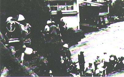
 Disaster in August, 1981 damaged road after breaching of the Nobori River embankment (Shiozawa Town) |
|
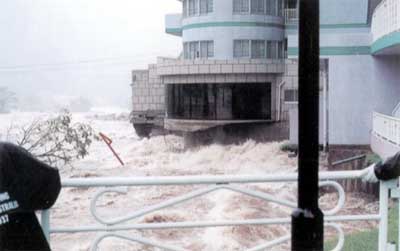
1981On 23rd August, stormy weather hit the Kanto Region and areas to the north, following the northward movement of Typhoon No. 15, causing much damage in many areas. The area controlled by the Yuzawa Sabo Works Office was flooded for the first time since 1935. Muikamachi Town(now : Minamiuonuma City) particularly suffered extensive damage, including 1,304 houses and 1,347 houses being inundated above floor level and below floor level respectively. The same typhoon caused equally devastating damage to Nakasato Village(now : Tokamachi City) in the lower reaches of Kiyotsu River and Sakae Village in Nagano Prefecture in the upper reaches of Nakatsu River. |
1998:Superlarge typhoon No. 5 of average strength, rammed into Japan at Shizuoka Prefecture early in the morning of September 16. It ran the length of Eastern Japan at a speed of 45 kilometers an hour, and blew out into the Pacific Ocean after 6 p.m. on the same day. It approached nearest Niigata Prefecture at around midday of the day, bringing about heavy rain. In Yuzawa, there was a rainfall of 167 mm within 24 hours until 10 a.m. Four houses were inundated above floor level in Muikamachi Town(now:Minamiuonuma City), and the number of houses flooded below floor level reached 171 in Uonuma and its neighborhood. |
|
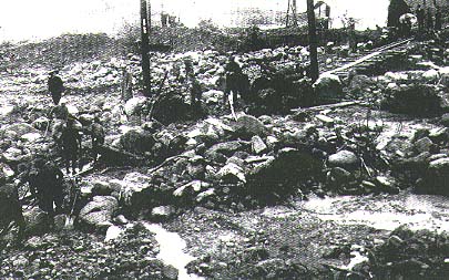
 Disaster in September, 1998: Upper reaches of Uono River (Yuzawa Town) |
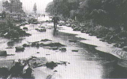
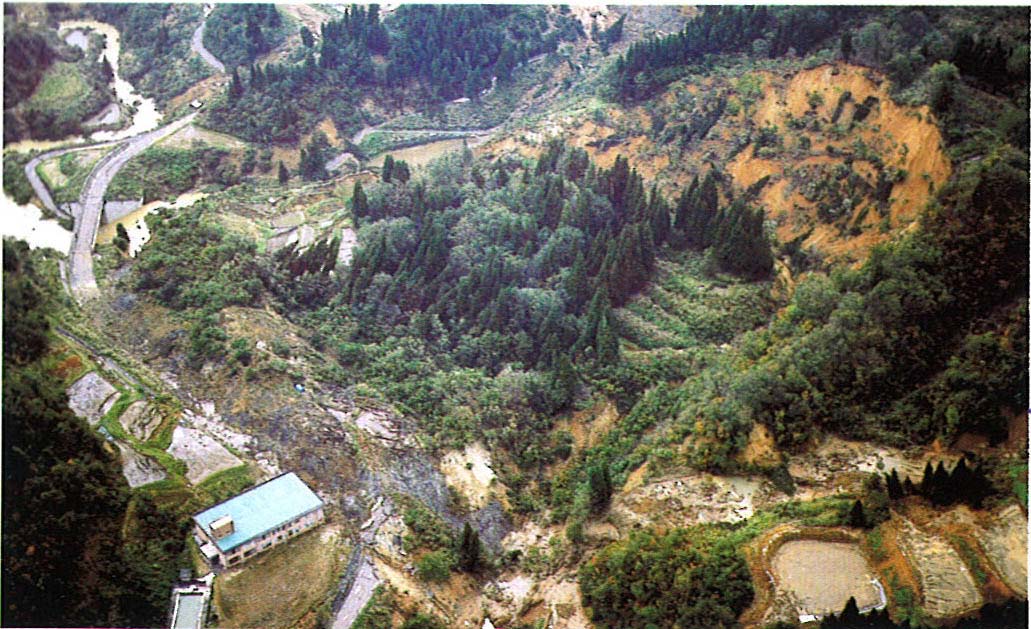 The 2004 Chuetsu Earthquake, Niigata Prefecture in October , 2004 (Nagaoka City(former : Yamakoshi Village)) |
|
2004At 17:56 on October 23, an earthquake with a magnitude of 6.8 and an epicenter 13km deep shook the Chuetsu region of Niigata Prefecture. A seismic intensity of 7 was observed (in Kawaguchi Town). (ÅeThe 2004 Chuetsu Earthquake, Niigata PrefectureÅf) In the Imokawa River Basin, this earthquake caused 842 land collapses and 124 landslides, and sediment blocked the river channel in 52 places. There was very serious damage, with road sections all over the region made impassable, houses flooded and property ruined by floodwater. This disaster prompted the start of government-run sabo work in the Imokawa River Basin. |