Policy of Sabo Project in Tateyama
The Tateyama Mauntain Area Sabo Office sets Kamitaki, located 18 km upstream of the river mouth, as the control point of sabo works for Joganji River. According to the current plan, the construction of sabo facilities is based on a policy of preventing disasters due to the substantial discharge of sediment caused by torrential rain with a return period of 150 years.

Sabo in Tateyama Caldera (Upstream Area)
Aiming for the following purposes, we have been developiong various types of sabo dams in Tateyama Caldera to control sediment discharge into the downstream area.

Many sabo dams have been constructed in the Tateyama Caldera to prevent the discharge of a large amount of sediment resulting from the collapse and erosion of some 200 million m3 of unstable sediment (Tombidoro mud) accumulated in the caldera.

Sabo dams decrease the velocity of the flow and also stabilize the flow direction, which would be effective for preventing from the expansion of the erosion at the river bed and on the river bank, thus gradually recovering greenery.

Hillside work have been sometimes applied to prevent from additional sediment production in the Tateyama Caldera. A number of hillside works have been constructed in the Tateyama Caldera to revive the vegetation to prevent the further erosion of devastated land.
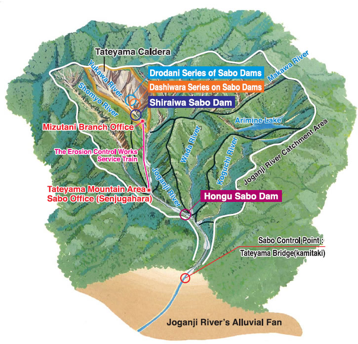
Shiraiwa Sabo Dam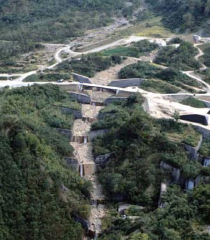
Dashiwara Series of Sabo Dams
Drodani Series of Sabo Dams and hillside works
Sabo in Middle Reaches
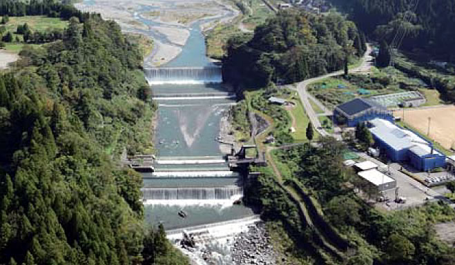
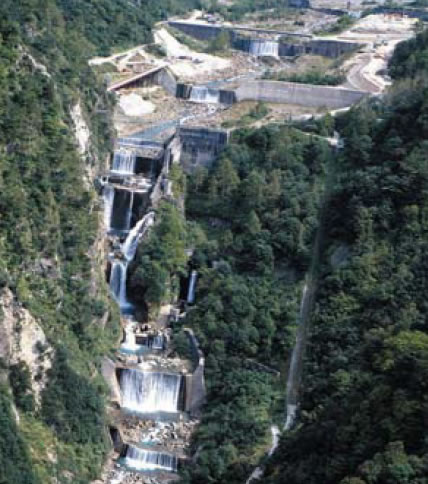
Hongu Sabo Dam

In the event of a flood, a large volume of discharged sediment in the mainstream of Joganji River is temporarily retained to avoid adverse effects on the downstream, which will be gradually discharged with water flow at normal times.
Sabo for Shomyo River
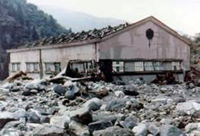
Shomyo Power Plant buried in sediment
The catchment basin of Shomyo River was severely devastated by torrential rain in 1969 and the area has subsequently been designated as the direct control sabo works. Henceforward, we consider countermeasures for sediment discharge at the upstream of Shomyo River in preparation for volcanic activities of Mt.Midagahara.
Sabo for Makawa River
The course of Makawa River is dog-legged because of the presence of the Atotsugawa Fault. Extensive collapse of the ground is observed in the upper reaches and there has been a steady sediment discharge from the steep valleys. To address such situation, the sabo dams designed to stop drifting woods have been planned, in addition to large-scale basic sabo dams.
Before rain
During the peak time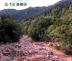
After driftwood was washed away